
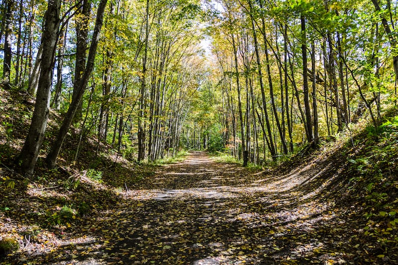
Southwest Virginia is one of the most beautiful hidden gems on the East Coast. And this guide names a handful of worthwhile stops on a Southwest Virginia road trip!
This post is broken into sixteen different sections – with a town or area being the focal point for the stop. Under each of these places, we have listed the top things to see in each place (or nearby)!
If you have any additional stops for this Southwest Virginia itinerary, let us know in the comments!
Contents
- Getting Around Southwest Virginia
- Southwest Virginia Road Trip Itinerary (& SWVA Towns)
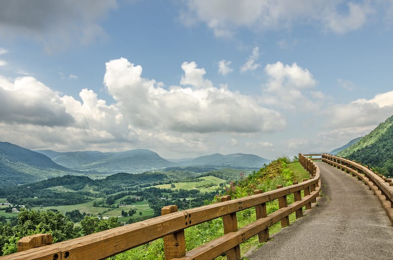
- Stop 1: Roanoke
- Stop 2: Wytheville
- Stop 3: Marion
- Stop 4: Mouth of Wilson
- Stop 5: Abingdon
- Stop 6: Bristol
- Stop 7: Hilton
- Stop 8: Duffield
- Stop 9: Clintwood
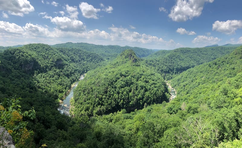
- Stop 10: Breaks
- Stop 11: Tazewell
- Stop 12: Bastian
- Stop 13: Pearisburg
- Stop 14: Newport
- Stop 15: Pembroke
- Stop 16: Natural Bridge
- More SWVA Travel Guides
- Pin this SWVA Itinerary
Getting Around Southwest Virginia
Many people who flock to this underrated part of VA are doing so by means of their own vehicle.
However, if you have flown into the state and are looking for a rental car, we recommend finding the cheapest options through Discover Cars!
>> Click here to see VA rental car options (and rates!)
Southwest Virginia Road Trip Itinerary (& SWVA Towns)
Stop 1: Roanoke
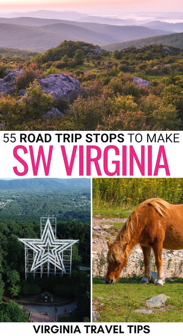
Mill Mountain Star
Mill Mountain Star, or Roanoke Star, is in Mill Mountain Park at an elevation of 1,045 feet.
The three stars are constructed of 2,000 feet of neon tubing and overlook the city of Roanoke. Roy Kinsey and his sons built the star as a Christmas decoration in 1949.
Since the star was so popular, it wasn’t dismantled after the holiday and has become a tourist attraction.
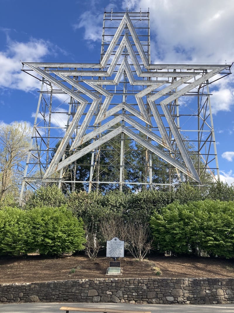
The Roanoke Star is easy to view from around Roanoke, but you can also head up to Mill Mountain Park and walk around the star and see how big it really is.
Besides the star, Mill Mountain Park also is home to 10 miles of trails, the Mill Mountain Zoo, wildflower gardens, a playground, and Discovery Center.
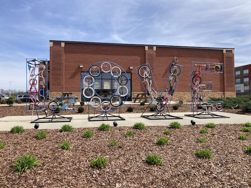
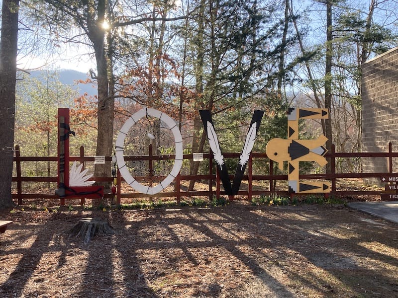
LOVEworks in Roanoke
Roanoke is home to three LOVEwork signs. You can find the Roanoke sign in Market Square at the corner of Norfolk Avenue SE and Market Street SE.
This 9’ x 5’ sign is a shout-out to the railroad that has been an essential part of Roanoke’s history.
The other signs are located at Northside High School at 6758 Northside High School Road on the Northside Middle School side of the building and in Southeast Roanoke at 1500 Bennington Street SE within the Roanoke River Greenway.
Stop 2: Wytheville
New River Trail State Park
Not far from Wytheville is New River Trail State Park.
This 57-mile-long park follows 37 miles of the New River along an old Norfolk Southern Railroad bed. If you want to hike or bike the trail, it officially begins and ends in Pulaski and Galax.
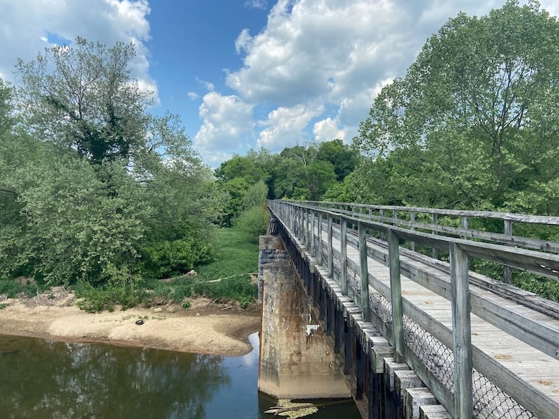
The trail goes through two tunnels and 33 bridges, three of them major.
New River Outdoor Adventures in Galax has bike rentals and shuttle service, and the Foster Falls access point has campsites and bike and horse rentals.
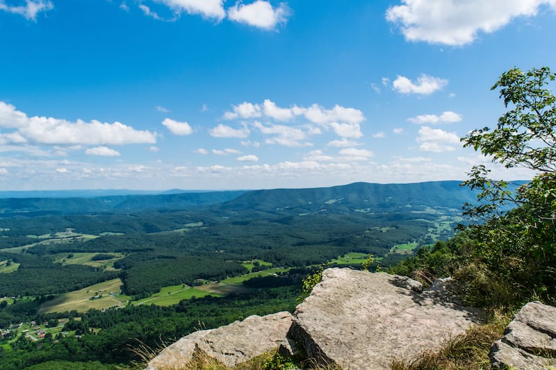
Big Walker Lookout
The Big Walker Lookout is an observation tower that offers climbers of 200 steps a fantastic panoramic view of the Jefferson National Forest, southwestern Virginia, and peaks in four additional states (WV, TN, KY, NC).
Besides the tower, there is a swinging bridge that you can partially walk across. Before the 2003 fire that burnt the general store, the swinging bridge connected the store and the tower platform.
The admission to hike to the top of the tower is $8 for adults and children 12+, $5 for children 3-11, and free for children younger than 3.
Today the new Big Walker General Store sits beside the tower and offers various souvenirs, local arts and crafts, delicious fudge, and creamy ice cream.
On summer and fall weekends, stop by Big Walker Lookout, a Crooked Road Affiliated Music Venue, and enjoy the music of local musicians.
Be sure to take your picture with Big Walker Lookout’s LOVEwork sign at the entrance to the tower and store.
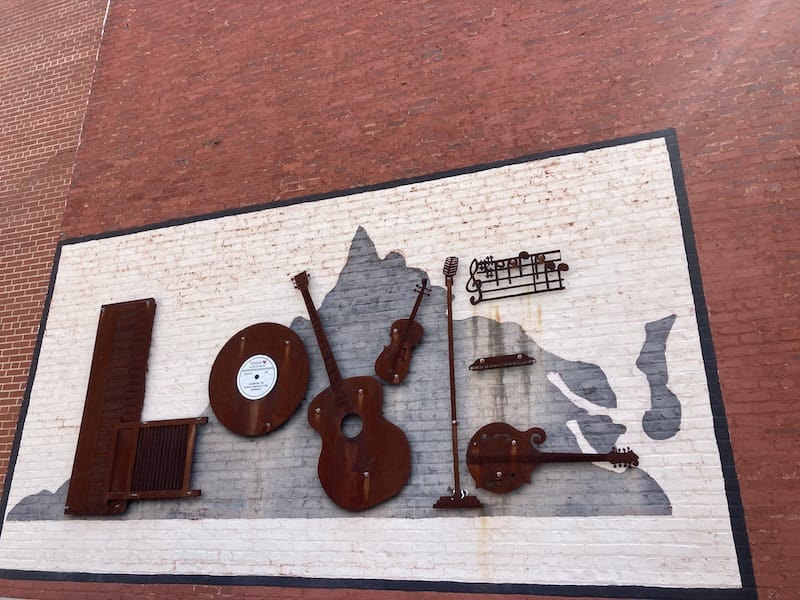
Wytheville LOVEwork
Be sure to head back into town to take a photo at Wytheville’s LOVEwork sign at 270 West Monroe Street. The sign honors Wytheville’s past, and the L reminds us of the importance of the railroad.
The O features a hot air balloon that you can see at the annual Chautauqua Festival.
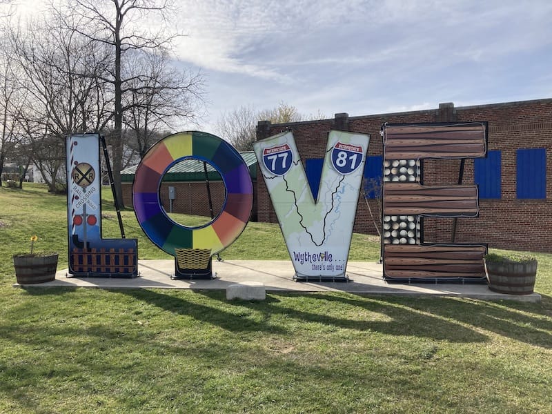
The V is a map of the two interstates, I-77 and I-81, that merge here. Baseball is a community favorite played just behind the sign at Withers Park, so the E features baseballs and bats.
Log House 1776 Restaurant
When looking for a local place to have lunch or dinner, stop at the Log House 1776 Restaurant. This two-story log house offers quite a history dating back to 1776 when the first part of the house was built.
In 1804 and 1898, additional rooms were added to the house, now used as small dining rooms to enjoy port tenderloin, chicken verde pecan, beef stew, catfish, and some salty Virginia country ham.
They offer unusual but delicious sides like fried grits, corn pudding, and stuffed squash.
After you finish your meal, head out back and stroll through the beautiful gardens or find a perfect gift or souvenir in the gift shop.
Stop 3: Marion
Hungry Mother State Park
Spend the day hiking, swimming, ziplining, or camping at Hungry Mother State Park.
The 3,334-acre park offers visitors a 108-acre lake that is the perfect place to take a dip or enjoy the sandy beach on a hot summer day.
You can also spend the day on the banks fishing. If you want to get on the water, head to the Visitor Center to rent a kayak, canoe, paddleboard, or paddleboat.
Hikers will enjoy the park’s nine trails, including the challenging hike to Molly’s Knob or the leisurely 5.7-mile Lake Trail Loop around the lake.
If you hike into the mountains, be aware that black bears are in the woods. You can enjoy a thrilling ride at Hungry Mother Adventures just outside the park boundaries.
It boasts having Virginia’s longest zipline. Sign up for this 2-hour adventure, and you will soar over the treetops and valley as you cross five zip lines.
The park also offers a mini zip for children as young as six.
Lincoln Theatre
Take in a show at the historic 500-seat Lincoln Theatre. The theatre holds a variety of shows.
It is home to the monthly taping of the Appalachian Music Heritage Foundation’s Song of the Mountains concert series.
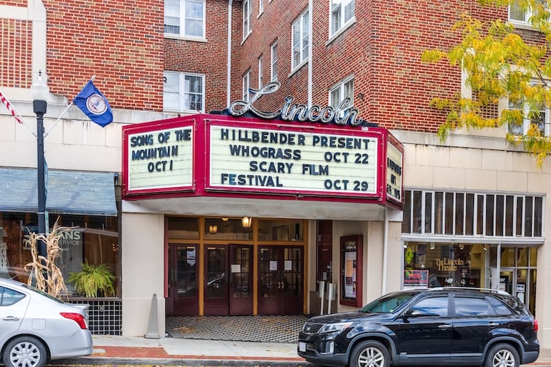
If you are into Mayan Revival-style art deco, the Lincoln Theatre is one of only three remaining in the United States with this form of architecture.
Marion LOVEworks
Next to the Lincoln Theatre, you will find Marion’s LOVEwork sign. The sign on Iron Street Mall has a black background and colorful steel letters.
Bring some chalk and write a message on the black background before taking your Instagram-worthy picture.
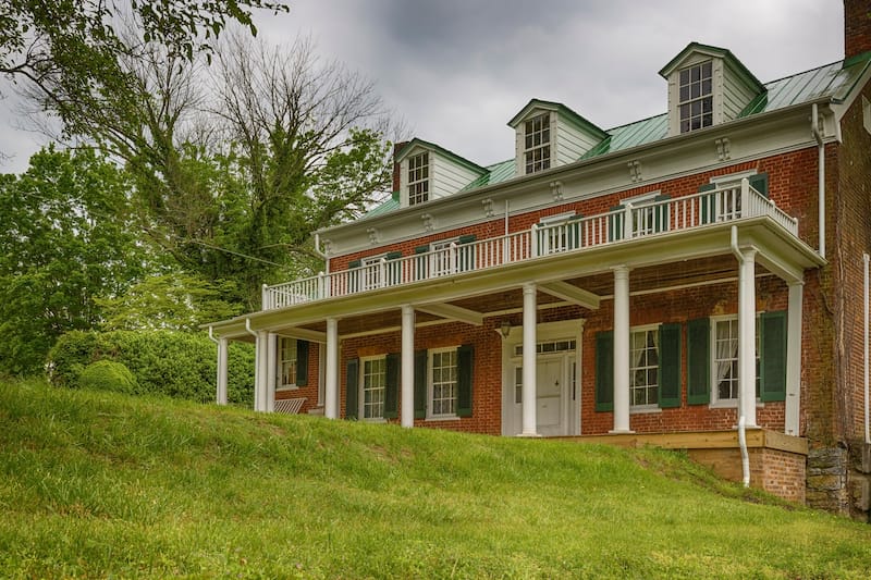
General Francis Marion Hotel
After a busy day of sightseeing, lay your head down at the General Francis Marion Hotel.
You will be greeted with a beautiful lobby right on Main Street. After checking in, relax on one of the balconies overlooking Main Street or get a drink in the historic “card room.”
Stop 4: Mouth of Wilson
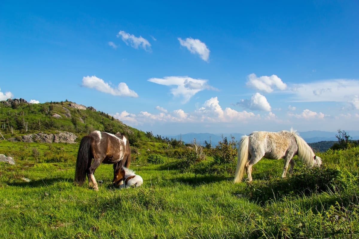
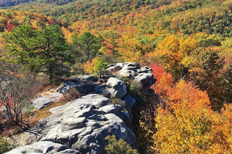
Grayson Highlands State Park
Grayson Highlands State Park offers beautiful views from an elevation of 3,700 to more than 5,000 feet.
From the park, you can hike to Mount Rogers, Virginia’s highest peak, access the Appalachian Trail, or explore Wilson Creek Waterfalls.
As you hike some of the 117 miles of trails within the park, you may even wander across the herd of wild horses that roam around Grayson Highlands State Park.
In June, hike the short piece of the Appalachian Trail that runs through the park and enjoy the beautiful rhododendrons.
For waterfall seekers, enjoy a moderate stroll along the 1.9-mile Lower Cabin Creek Trail loop, where you will enjoy one of the park’s main attractions, the Lower Cabin Creek Falls.
If you want to spend a night or two in the park, 89 campsites, four yurts, and a two-room bunkhouse are available for rent.
Stop 5: Abingdon
VA Creeper Trail
The Virginia Creeper National Recreation Trail spans nearly 33½ miles from Abingdon to almost the North Carolina border near Whitetop.
This trail, named after the trains that slowly made the daily 1,600-foot ascent into Whitetop Station, is perfect for biking, hiking, and horseback riding.
The trail, which Daniel Boone used during his pioneering days, was first created as a Native American footpath. In later years, the railway used the route in the 1880s before being turned into a recreation trail.
Make the day of it by renting a bike (or bringing your own) and cross over 50 bridges and trestles as you wind along Whitetop Laurel Creek.
To make a more leisurely ride, begin at the Whitetop Station at 3,500 feet and glide 17 miles into Damascus, where you will be at 1,900 feet in elevation.
You can then continue on the famous rail trail to Abingdon and pass the Abingdon Vineyard.
Along the trail, you can rent bikes at various outfitters, including the Virginia Creeper Trail Bike Shop in Abingdon, Sun Dog Outfitters in Damascus, and Blue Blaze Bike and Shuttle.
Many bike shops also offer shuttle transportation to many of the ten access points, so you only have to ride one way.
To ride the entire trail, plan on peddling for 5½ hours. This will give you time to make several stops to enjoy the scenery, bridges, and lunch or snack.
At the Abingdon VA Creeper Trail Visitor Center, take your picture at the LOVE sign phone booth.
SWVA Cultural Center
A stop at the SWVA Cultural Center begins with a photo op with their VA LOVEwork sign.
Inside you will find some of the best regional crafts, jewelry, and home decor from local artisans in the Marketplace.
At the Visitor Center, you can pick up brochures about other local attractions, restaurants, and lodging to make your SWVA vacation perfect.
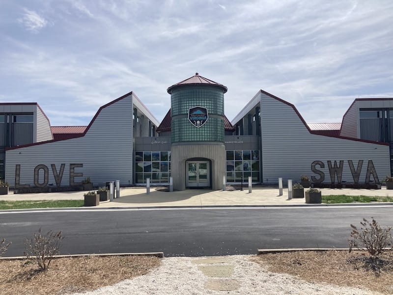
The centerpiece map in the Visitor Center is a site to behold. It is hand-carved and showcases four cities and 19 counties.
The Culture Center is also one of the music venues along The Crooked Road: Virginia’s Heritage Music Trail.
In the theater, you can enjoy classic bluegrass and gospel music, open jam nights on the 1st, 3rd, 4th, and 5th Thursdays beginning at 6:30 PM, and youth musicians on the 2nd Thursday.
The Crooked Road: Virginia’s Heritage Music Trail
Three hundred thirty-three miles of Southwest Virginia’s scenic mountain roads have been named The Crooked Road.
You will find 27 Wayside Exhibits, Country Music Museums, and nine major and 150 affiliated music venues along this route.
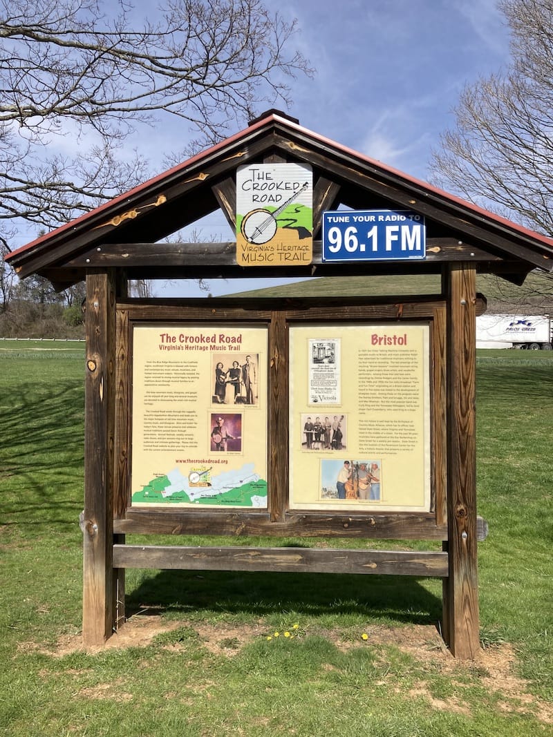
As you travel The Crooked Road, you will learn more about the history of country music, and be sure to stop off and enjoy the traditional music that fills this region.
The Crooked Road Interpretive Waysides offer insight into the area’s country music history and musicians and a 5-minute recording that you can access on your radio.
The Town of Abingdon Wayside sign is at 150 West Main Street, Abingdon.
Historic Abingdon
Before leaving town, stroll through the 20 blocks of Abingdon’s Historic District.
Here you will find the possibly haunted historic Martha Washington Inn and Spa, the Barter Theatre, Revolutionary and Civil War sites, Abingdon Muster Grounds, and the Overmountain Victory National Historic Trail.
In front of the Barter Theatre, you will find Abingdon’s LOVEwork sign at the fountain that celebrates Abingdon’s early days as a frontier town.
The wolf within the O dates back to a legend about Daniel Boone driving a pack of wolves away from his hunting dogs, and later he gave the area the nickname Wolf Hills.
Food City LOVEwork
Make one final stop at the Food City on Cook Street to see how the employees used various bike parts to create the LOVEwork sign at the Virginia Creeper Trail entrance.
Stop 6: Bristol
Birthplace of Country Music
Birthplace of Country Music, a Smithsonian Institute affiliate, pays tribute to the Bristol Sessions that took place in 1927 and started the country music boom.
The 24,000-square-foot museum offers visitors an inside look through exhibits dealing with the 1927 Bristol Sessions.
The exhibits showcase the Carter Family and Jimmie Rodgers’ first recordings, interactive displays, photographs, and watch Radio Bristol broadcast live.
The museum also holds about 20 outdoor concerts and festivals throughout the year, including the Bristol Rhythm and Roots Reunion in September.
State Street
While in Bristol, take the opportunity to stand in the middle of State Street (be careful of the traffic) and take a photo of one foot in Virginia and the other in Tennessee.
All along State Street, brass markers state Virginia on one side and Tennessee on the other.
As you stroll down State Street taking a historic tour of Downtown Bristol, stop at Burger Bar. It is said that this classic 1942 diner was the last place Hank Williams, Sr. was seen alive.
Then cross over to Piedmont Avenue and take a picture of LOVEwork Bristol at 629 State Street, which features a banjo, washboard, mandolin, piano, and fiddle. The sign pays tribute to the Carter Family.
Stop 7: Hilton
Carter Family Fold
If you are in Bristol or passing through the little crossroads of Hilton on a Saturday night, stop at the Carter Family Fold for live bluegrass and mountain music.
It was here in Poor Valley that the Carter Family lived. A.P. and Sarah Carter’s daughter Jeanette ran the store here and offered music sessions.
Today you won’t find the music coming from the store but from A.P. Carter’s granddaughter Rita Forrester’s shed, which has 850 seats.
Doors of the Carter Family Fold open each Saturday at 6:00, with music beginning at 7:30. Tickets are $11 for adults and children 12+, Children ages 6-11 are $3, and children younger than six are free.
The Crooked Road Interpretive Wayside – Hiltons Wayside – Scott County
The Crooked Road Wayside near Hilton pays homage to the Carter Family.
Stop by and learn a bit more about the roots of country music at 204 State Route 709, Gate City.
Stop 8: Duffield
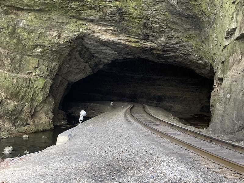
Natural Tunnel State Park
Natural Tunnel State Park is a great place to spend an hour or two in nature. The main attraction in the park is an 850-foot-long tunnel that reaches up to 100 feet high and is located in a 300-foot-deep canyon.
The tunnel was formed as the rock was dissolved and washed away by groundwater and Stock Creek.
Since 1890, trains have used the tunnel to travel between Duffield and Gate City and beyond.
Today, if your timing is right, you can stand beside the train tracks at the tunnel opening and wave to the conductor as the train goes down the track.
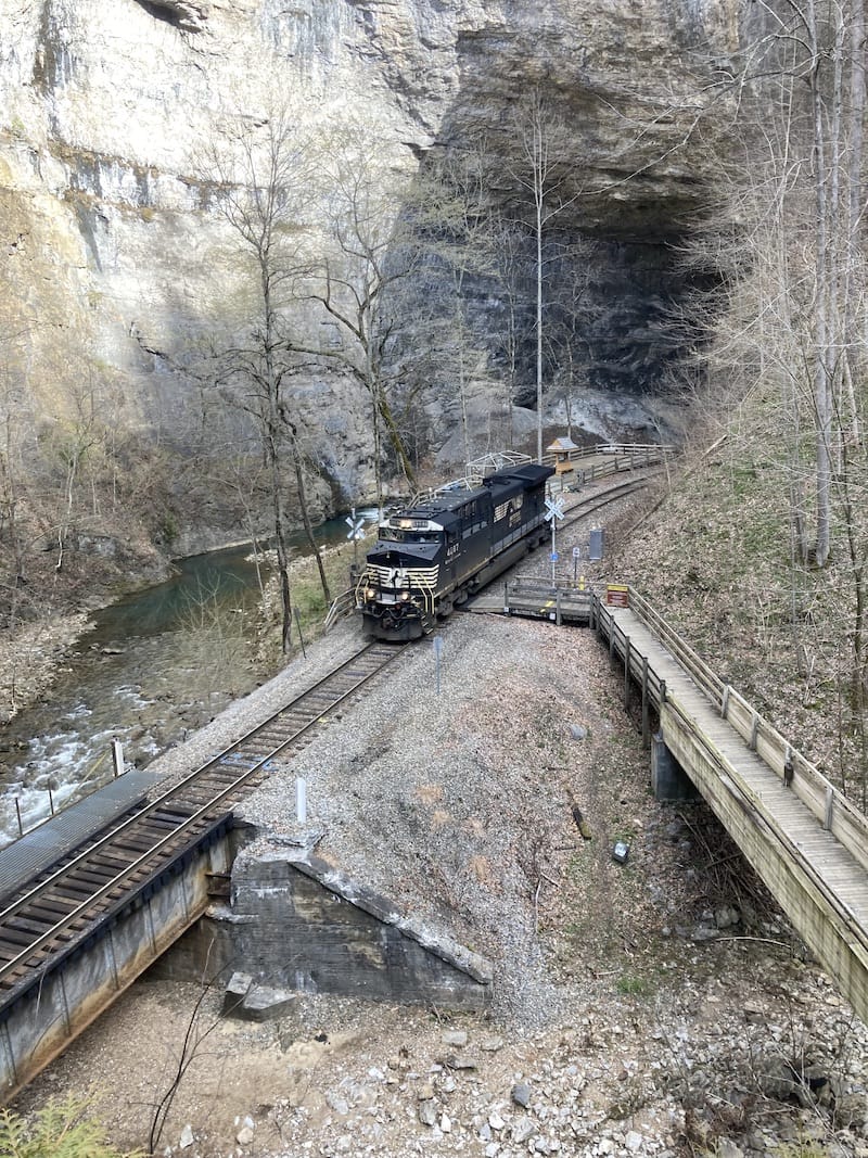
To get to the tunnel, walk down the 1/3-mile trail that switchbacks down the side of the canyon, or during the summer, take the chairlift down to the tunnel platform.
The chair lift is open during April, May, and October weekends and every day between Memorial Day and Labor Day.
The chairlift is $5 for a round-trip ride or $4 for one way. Children younger than three ride the lift for free.
Besides the Tunnel Trail, there are eight other trails ranging in difficulty and length from 0.13 miles to 2.07 miles. The popular hikes are to Lover’s Leap and the Carter Log Cabin, the park’s oldest building.
Kids will have a blast exploring the train exhibits near the parking lot. The park also offers Clinch River canoe and kayak trips and cave tours throughout the year.
Five minutes down the road from the tunnel, explore the Wilderness Road Historical Area, where the migration trail leading to Cumberland Gap went through.
Pioneers stopped here at the Anderson Blockhouse, which has since been recreated.
If you are looking for a place to stay, Natural Tunnel State Park also has 14 cabins that are rented by the week, a six-bedroom lodge, yurts, and two campgrounds with a total of 34 sites with water and electric hookups.
The park entrance is $5 per car.
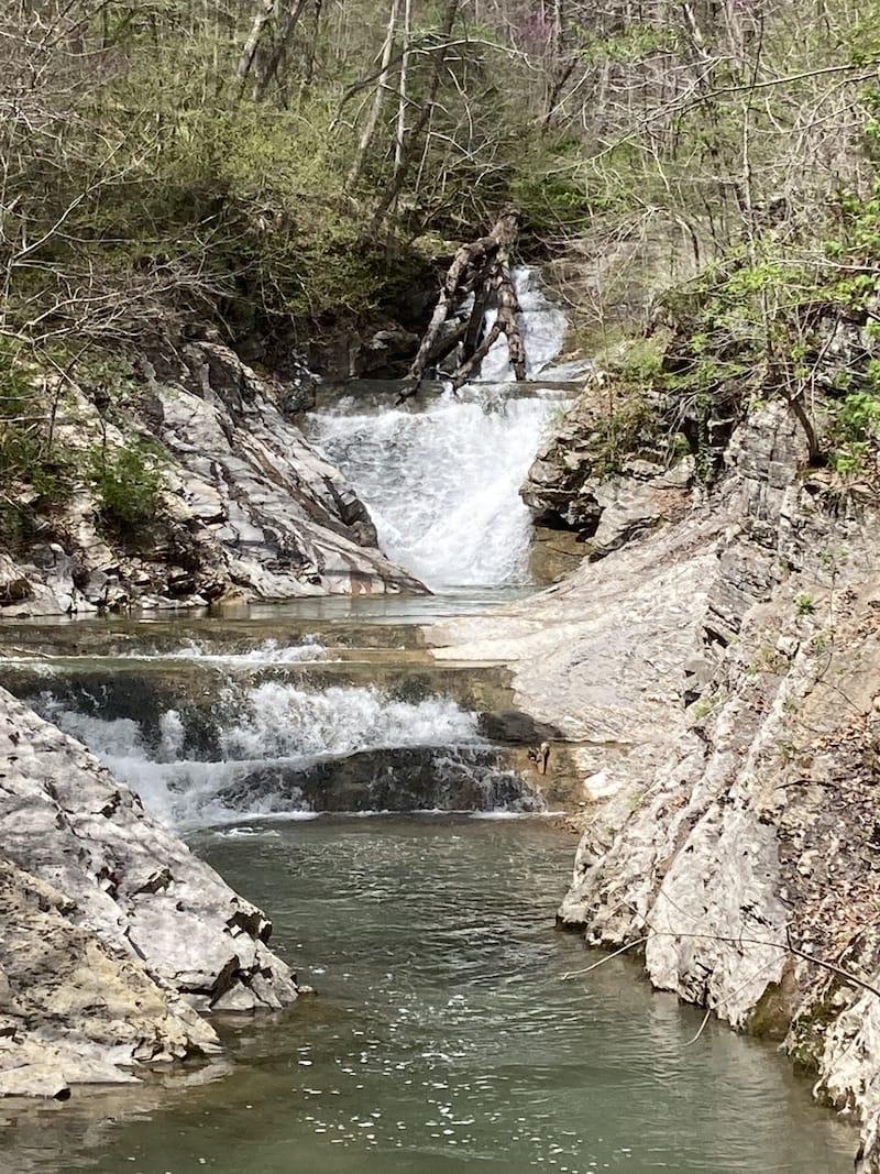
Devil’s Bathtub
The Devil’s Bathtub is an aquamarine water pool surrounded by beautiful green, moss-covered rocks.
For any hiker, this is a must-do hike when in the area. However, be prepared for a nearly 8-mile out-and-back challenging hike leading you through 13 creeks that flow with icy cold water.
At the Y in the trail, after the first creek crossing, there is a sign that indicates the Devil’s Bathtub in both directions.
The right trail is a 7-mile trail with no creek crossings, while the route to the right is shorter and much more traveled and has the remaining dozen creek crossings.
Before reaching the bathtub, you will encounter a beautiful swimming hole with two rope swings and a waterfall.
Even though this area is gorgeous and will call out to you to spend some time here, continue over the rocks past the waterfall to the Devil’s Bathtub.
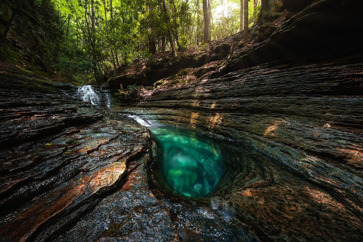
Once you reach the Devil’s Bathtub, slide yourself into the icy cold water and enjoy the beauty of the cascade that flows into the bathtub and pools.
Note: This area is known for flash floods, so if there have been any recent rains, do not attempt the hike. Also, abandon the hike if the water is over ankle-deep in the streams.
Water shoes or neoprene socks are also advised due to all the stream crossings.
The Crooked Road Interpretive Wayside
Make a quick stop at the intersection of Route 58 and Route 23 in Duffield and learn a bit about the music inspired by the Duffield Wayside area.
Daniel Boone Wilderness Trail Interpretive Center
The Daniel Book Wilderness Trail Interpretive Center is part of the Natural Tunnel State Park, and the center is open from 10:00 AM – 6:00 PM every weekend.
Here you can learn about America’s westward expansion along the Wilderness Road.
From the center at Kane Gap, you can see how unforgiving the terrain was to those early settlers.
Inside the center, you will find a museum with exhibits about the brave settlers who traveled between Sycamore shoals and Cumberland Gap.
See how talented you are at getting a spark by striking the flint at the flint exhibit.
Stop 9: Clintwood
Birch Knob Observation Tower
The Birch Knob Observation Tower allows visitors to see six states from its perch in Dickenson County.
To reach this new tower constructed in 2003, you will walk an endless stare case of 183 steps. Once at the top, you will be above Pine Mountain at 3,144 feet in elevation.
On a clear day, you can see as far away as Tennessee, Kentucky, West Virginia, North Carolina, Virginia, and even Ohio.
To aid visitors, you will find an interpretive sign that points out the states as well as the history of both the new and old towers.
The observation tower is closed during winter but is open from late March through December.
There is no fee to climb the tower.
After climbing to the overlook, take another challenge and hike the 1-mile Pine Mountain Trail that begins at the parking lot and continues down the mountain to Jenny Falls.
The Ralph Stanley Museum
In the 100-year-old 4-story house along Clintwood Main Street, you will find the Ralph Stanley Museum and Traditional Mountain Music Center.
The museum, which honors Ralph and Carter Stanley and the Clinch Mountain Boys, along with traditional Appalachian Mountain music, is one of the major venues along The Crooked Road.
Inside you will find an interactive museum where you can see and hear the music from the SW Virginia mountains.
As you explore the various rooms, you will follow Ralph Stanley’s career and discover how the mountains influenced his music.
Throughout the museum, you will find a wide selection of memorabilia, banjos, and other instruments, and awards, including Stanley’s Grammy for the song O Death which was featured in the movie O Brother Where Art Thou.
The museum is open Tuesday through Saturday, 10am to 4pm. It is closed Sundays and Mondays, as well as major holidays. Admission is $10.
If you are looking for a place to stay, you can rent the museum’s third floor for the night. You can rent the two-bedroom suite with a king bed in each room and a kitchen as a whole or by the bedroom.
LOVEworks at the Dickenson County Visitor Center
Diagonal from the Ralph Stanley Museum, you will find Clintwood’s LOVEwork sign that features Clintwood in each of the four seasons.
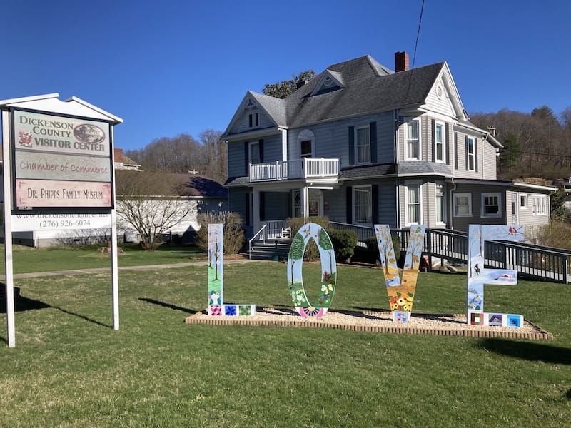
On the back of the sign, the LOVE continues with trees full of bluebirds.
Stop 10: Breaks
Breaks Interstate Park
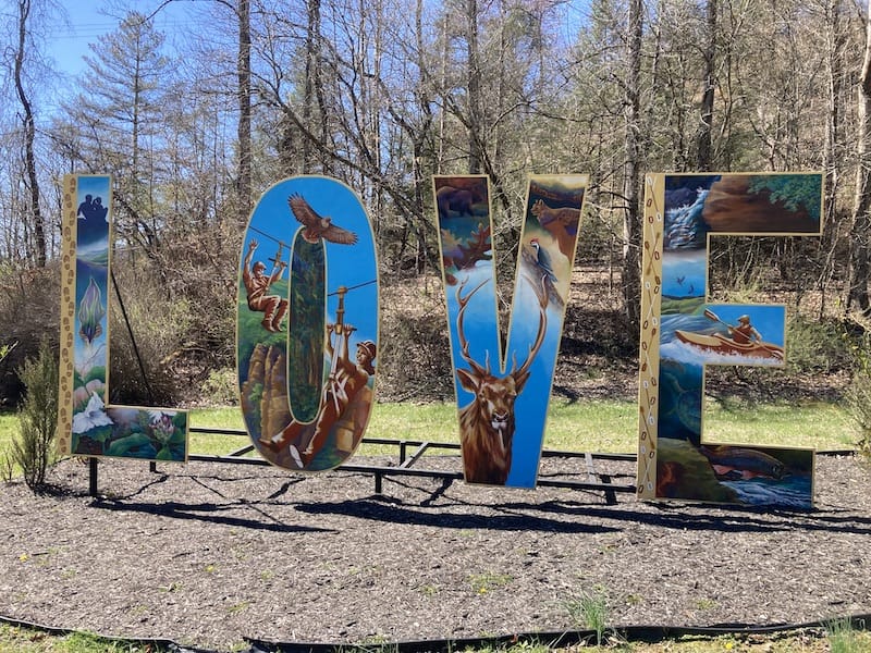
As you enter Breaks Interstate Park, notice the beautiful LOVEwork sign at the entrance.
The sign showcases what you can see and do in the park, and the L gives you a glimpse of hiking, while the O shows how you can take on Breaks Canyon by ziplining.
The V features some animals you may be lucky enough to see or challenge yourself on the Russell Fork River, as shown on the E.
Breaks Interstate Park is in both Virginia and Kentucky and was once the Cherokee and Shawnee Indian’s hunting grounds.
In 1767 Daniel Boone passed through this passage and named the area “The Breaks” as he pioneered westward.
The park’s entrance fee is $3.00 per car, and it is open year-round except during winter snow storms.
Breaks Interstate Park offers 14 hiking trails that range from 2/10 miles to the strenuous 2.4-mile Bottom of the Breaks Trail that leads you down the 800-foot rocky mountainside to Russell Fork.
Take the 0.2-mile Tower Tunnel Trail to the Tower Tunnel Overlook for a more leisurely stroll.
The State Line Lookout offers parking right beside the lookout.
Besides hiking, try biking the 12 miles of trails, canoe, kayak, or pedal boat around Laurel Lake.
Want more excitement? Spend 1½ – 2½ hours ziplining between the overlooks or climbing the rock cliffs. There are over 300 rock climbing routes you can choose from.
All the hiking and adrenaline-pumping activities will work up an appetite, so stop at the Rhododendron Restaurant and enjoy breakfast, lunch, or dinner in the park while enjoying the views from the main dining area.
Spend a spring or fall Saturday evening (5:00 – 8:30 PM) on an Elk Viewing Tour.
During the three-hour tour, you will take a bus to the Virginia Elk Restoration zone, where the Rocky Mountain elk were introduced to the area in 2012.
Today the Virginia herd has more than 250 elk. Here you will have a picnic dinner as you watch the elk. Tour tickets are $35 per adult and children 13+ and $20 for children 12 and younger.
Once here, you will want to stay in the beauty of the Grand Canyon of the South, so why not rent one of the lakefront cabins, woodland cottages, yurts, or one of 70 rooms in the lodge?
The park also has a 138-site campground for tents and RVs open from April through October.
Stop 11: Tazewell
The quaint little town of Tazewell offers travelers a bit of everything, from hiking to scenic byways, mountain passes, the winding Clinch River, and green pasture land. Along Main Street, you will find a variety of shops and restaurants.
Tazewell has plenty of street festivals throughout the year to enjoy.
Each summer (May – September), Tazewell holds Music on Main and Cruise-In on the fourth Saturday, and between June and August, the first Fridays is a time to have fun at First Fridays.
The Main Street Moments Festival happens in July on the fourth Friday and Saturday. The fun continues in October with Oktobrewfest and the Main Street Winter Market in December.
Tazewell is also a popular spot for bikers looking to drive the 32 miles of Route 16, named Back of the Dragon, between Tazewell and Marion.
This route is one motorcycle enthusiasts flock to for the breathtaking views and over 400 curves as they travel over the Big Walker, Brushy, and Clinch Mountains.
Back of the Dragon Welcome Center
Before or after your trip down Back of the Dragon, stop in at the Back of the Dragon store and brewery to get all the latest tips and information about the route, or sit back and talk with others about the highlights of their ride.
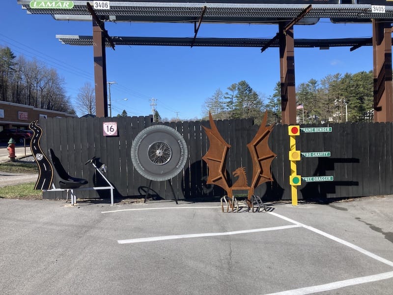
If you do not have a motorcycle, the Back of the Dragon rents three-wheeled Polaris Slingshots that hug the switchback curves and offer a clear view of all the scenery.
Before leaving, take your picture beside or in their LOVEwork sign, created with motorcycle parts, at the edge of the parking lot.
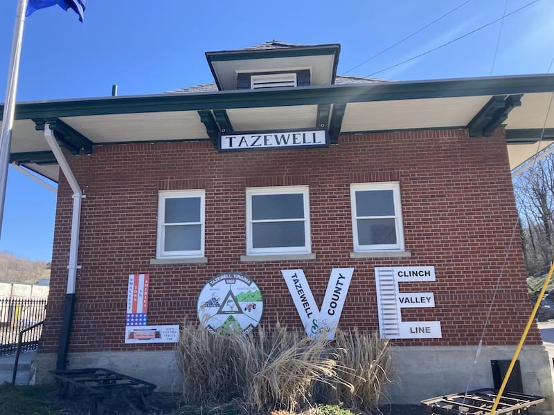
More LOVE in Tazewell
Tazewell not only has a LOVEwork sign at the Back of the Dragon but others at the Tazewell County Historical Society at the end of Main Street at 100 East Main Street and the Tazewell Train Station at 135 Railroad Avenue, North Tazewell.
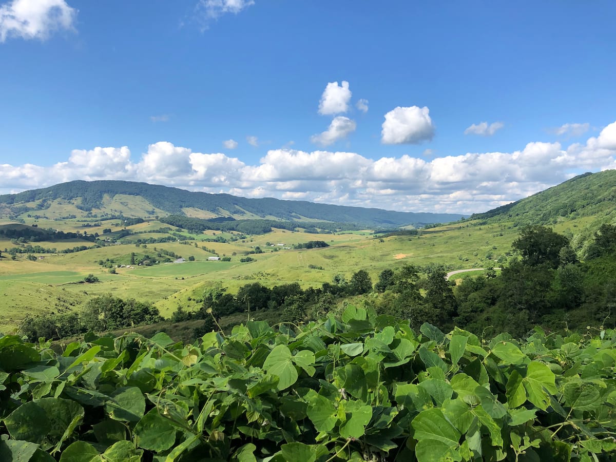
Burke’s Garden
The Burke’s Garden area of Tazewell is in a valley east of the mountains and Tazewell.
To get to Burke’s Garden, be prepared to twist and turn over the mountain road (Burkes Garden Road – Route 623).
Once you come over the mountain, you will be greeted with a LOVEwork barn quilt. This valley which sits at 3,000 feet in elevation, is Virginia’s highest valley.
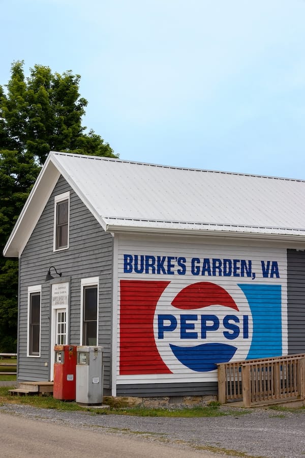
Drive around the area, and explore the village and Amish general store.
Stop in at Matties Place and have breakfast or lunch, pick out some fresh baked goods, or rent some bikes and bike around the area.
Stop 12: Bastian
Wolf Creek Indian Village
A visit to Wolf Creek Indian Village will take you back to the early 1500s. The village was discovered and an archaeological dig was done in 1970.
The reconstructed Native American village of a replica of the Easter Woodland Indians village was created.
Here, you can see what life was like through basket making, tool, arrowhead making, and hide tanning.
Tour guides will share stories of what was like for the families that lived at the site many years ago. Self-guided tours are available for those who wish to explore on their own.
The museum opened in 1998 and offers visitors a chance to explore educational displays and artifacts.
Cost: Museum only – $6 per person. Museum and village – Adults (18-54) – $15, Seniors, Military Veterans, and First Responders – $14, Children (5-17) – $10.
Outside the museum doors, you will find the LOVEwork at Wolf Creek Indian Village. The sign was designed by a local high school girl inspired by Native American culture.
You will find a peace pipe, a dream catcher, feathers, and symbols in the sign.
Stop 13: Pearisburg
Hiking on the Appalachian Trail – Wood’s Hole to Pearisburg
If you do not have time to hike the entire Appalachian Trail that stretches 2,190 miles from Mount Katahdin, Maine, to Springer Mountain, Georgia, try just a piece.
Virginia is home to about a fourth of the trail’s total length, or 555 miles.
The 10.4-mile portion from Pearisburg to Wood’s Hole is a very picturesque section as it climbs to Angels Rest at the peak of Pearis Mountain, then follows the mountain ridgeline to the Woods Hole Hostel.
The Wood’s Hole Hostel, open Mid-March through Mid-November, offers lodging for AT hikers along with breakfast ($11) and dinner ($16).
LOVEwork in Pearisburg
As you pass by North Main Street in Pearisburg, stop at the LOVEwork sign and marvel at the 3,500+ rocks the Giles County school children painted.
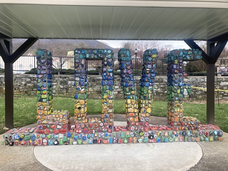
Nearly every child aged 4 through 18 painted a rock to represent themselves during the 2017-18 school year.
Stop 14: Newport
Clover Hollow Covered Bridge
The Clover Hollow or Sinking Creek Covered Bridge offers a beautiful spot to rest or enjoy a picnic beside Sinking Creek.
The bridge, just 1½ miles off Route 460 in Newport, makes it an easy stop. The striking 70-foot red bridge with the green roof is very eye-catching as you make the bend approaching the bridge on Clover Hollow Road.
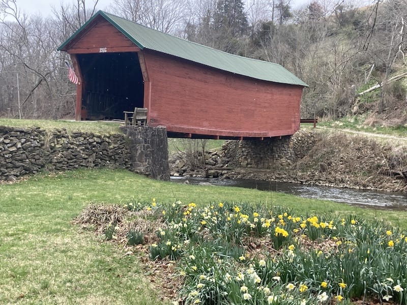
The bridge, built in 1916, is only open to foot track. Inside the bridge, you will find several historical displays and a log to sign for those who visit.
Stop 15: Pembroke
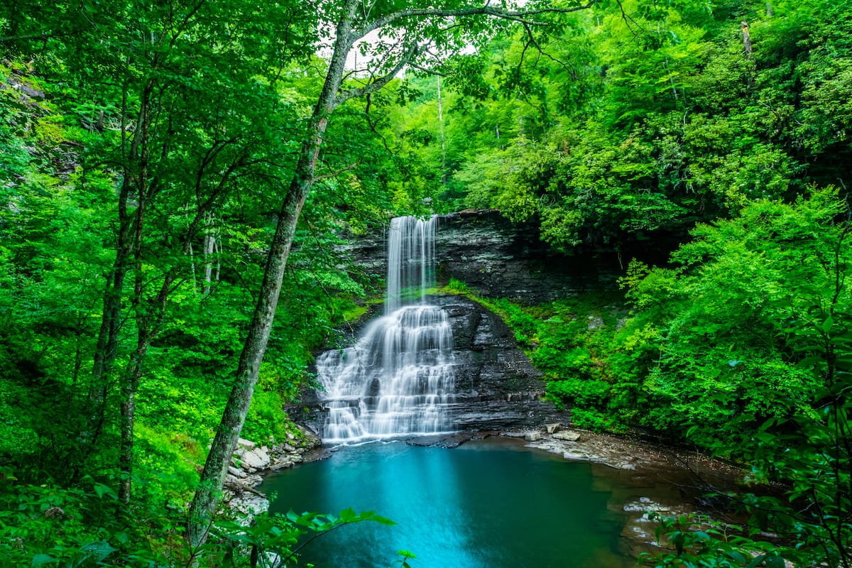
Cascade Falls
Along Route 460 between Pearisburg and Christiansburg, you will want to stop and take a beautiful hike along the Cascades National Recreation Trail. The main attraction along the 4-mile loop trail is the 66-foot waterfall.
When you arrive at the trailhead, you will find that there is a $3 parking fee. There are envelopes that you deposit your money in and put the receipt on your car dash.
Since the falls are in the Jefferson National Forest, the America The Beautiful Interagency Pass is accepted here. At the trailhead, you will also find toilets and picnic tables.
The well-marked trail is a moderately challenging loop with an elevation gain of 711 feet and traverses along a rocky path that takes you through the forests to the falls. The trail has both an upper and lower path.
I suggest taking one on the way out and the other on the way back. The upper trail is more challenging because you have to climb up in elevation a bit more, while the lower path is more scenic.
Along the route, you will pass by plenty of benches perfect for resting and an old boiler from a sawmill that was along the Little Stony Creek banks in the 1920s and 1930s.
The lower trail often follows closely beside the creek, which makes for lovely scenery and spots where you can take off your shoes and splash in the water.
Once you get to the falls, you can enjoy swimming in the pool beneath the falls or hanging out on the surrounding rocks.
You will find several viewing platforms to see the falls from different angles. Head to the upper platform and watch the water crash onto the rocks below.
Plan on allowing yourself about 2 hours to hike the trail, plus time to enjoy the falls and scenery along the way.
Stop 16: Natural Bridge
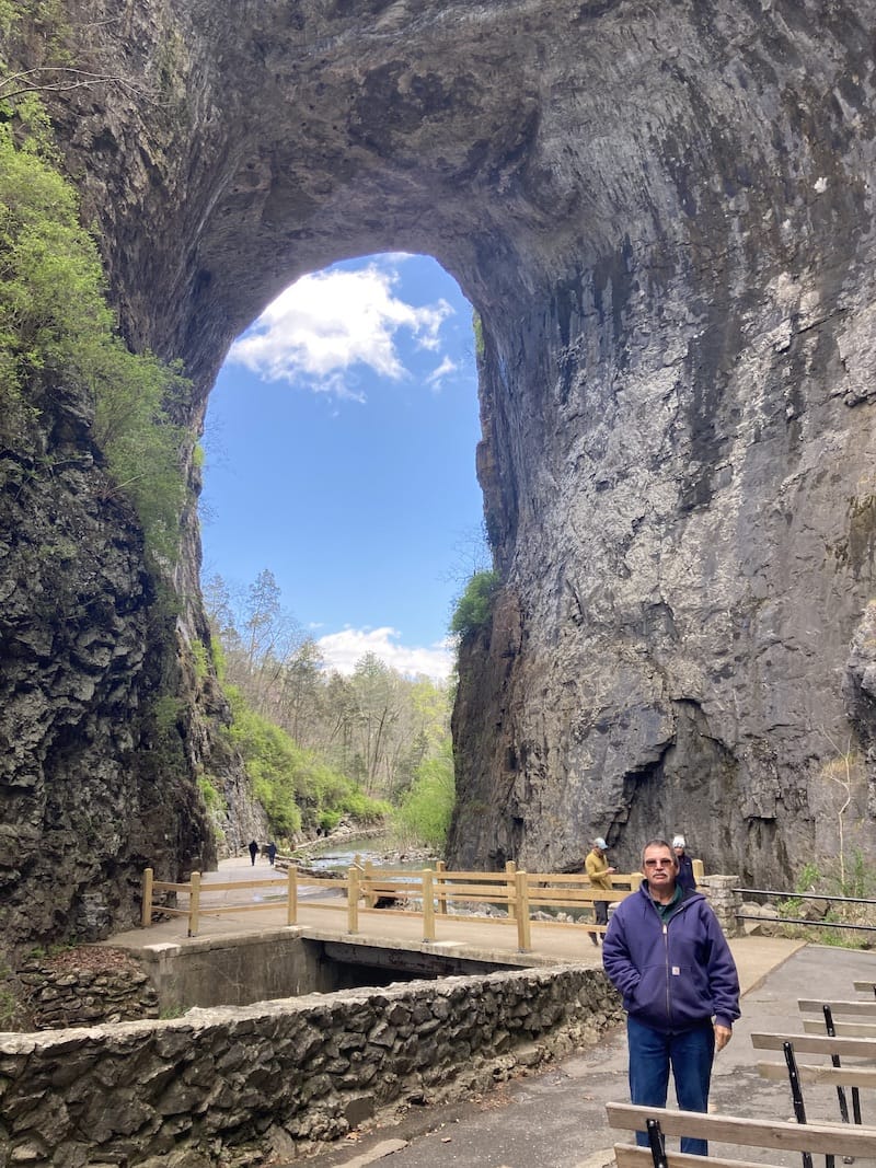
Natural Bridge State Park
Natural Bridge State Park became the 37th Virginia State Park in 2016. Before this time, it was surveyed by George Washington and owned by Thomas Jefferson and other private citizens.
Begin your time at Natural Bridge State Park in the Visitor Center and learn about the area.
The 8/10-mile Cedar Creek Trail is an easy walking trail leading you along the stream, under the natural bridge, past a living history village, and finally dead-ending at a waterfall.
From the Visitor Center to the natural bridge is a 3/10 mile walk, mostly down flights of stairs. Once you descend the stairs, the wide trail will quickly lead you under the natural bridge.
Along the path, there are plenty of places to snap terrific pictures.
Once you pass under the bridge, there are benches to rest or to listen to ranger talks. Continue along the trail to the Monacan Indian Living History Village.
During summer weekends, you can learn more about the Native Americans that once lived in this area from interpreters who share how they wove baskets, made pottery, and produced tools.
After passing the village, you will come face to face with the 30-foot cascading Lacy Falls.
Even though Cedar Creek Trail is the most popular trail in the park, you can hike more than six more miles of trails within the park.
Once back at the top of the hill, take your picture with the lovely LOVEwork sign that showcases the natural bridge and waterfall. On the backside of the sign, you will find seasonal trees.
Note: Talk with one of the park rangers if you cannot climb the stairs. There are accommodations for accessibility.
Did we miss any of the best stops on a Southwest Virginia road trip? Let us know in the comments!
More SWVA Travel Guides
Pin this SWVA Itinerary
Laura Gray is a travel blogger and retired teacher. She is from Western Pennsylvania but has lived in Virginia for the past 30+ years. During the summer months, you will find her enjoying the beach in her hometown when not out on an adventure. Laura thrives on creating itineraries to make the most of each place she visits. She enjoys exploring National Parks (Laura has explored 1/3 of all the US National Parks), waterfalls, and beaches. Her travel blog posts have been featured on nearly a dozen sites.